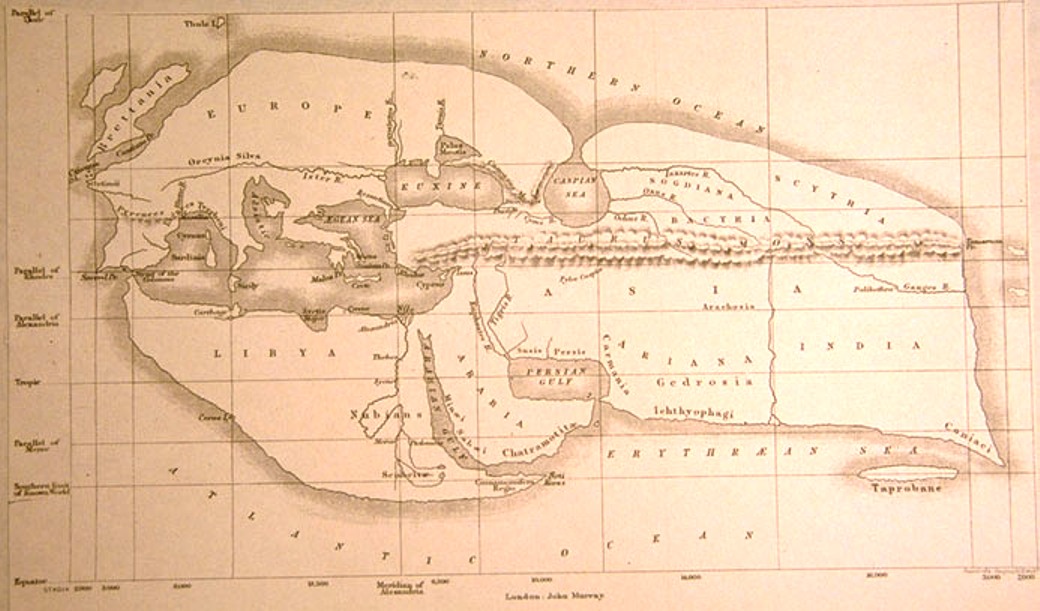
Eratosthenes’ Map
Eratosthenes (276–194 BC), a polymath of antiquity, stands as a beacon in the history of cartography, having drawn an advanced world map that synthesized insights from the expansive campaigns of Alexander the Great and his successors. His map was a revolutionary step, particularly in enlarging Asia to align with the newfound understanding of its actual size.

Remarkably, Eratosthenes wasn’t just a mapmaker; he was the first to introduce parallels and meridians into the realm of cartography, a groundbreaking realization affirming his grasp of the Earth’s spherical nature. In his magnum opus, the three-volume “Geography,” Eratosthenes not only described but meticulously mapped the entirety of his known world.
His contributions didn’t stop at representation; Eratosthenes ingeniously divided the Earth into five climate zones—an intellectual leap that showcased his profound understanding of geography. From the freezing zones around the poles to the temperate zones and the equator-tropics region, his categorization laid the groundwork for comprehending global climatic variations.
Eratosthenes can be heralded as the true inventor of geography. In shaping his world map, he not only created a visual representation but also introduced enduring terminology still employed today. He adorned the Earth’s surface with grids of overlapping lines, weaving a complex network of parallels and meridians that linked every corner of the known world. This innovation empowered individuals to estimate distances from remote locations, forever changing the way we perceive and navigate the globe.
Within the pages of “Geography,” Eratosthenes left an unparalleled legacy. Over 400 cities found their place on his map, a feat previously unparalleled in human history. His meticulous approach to geographical representation and classification elevated cartography to new heights, paving the way for future explorations and laying the foundation for our contemporary understanding of the world.
