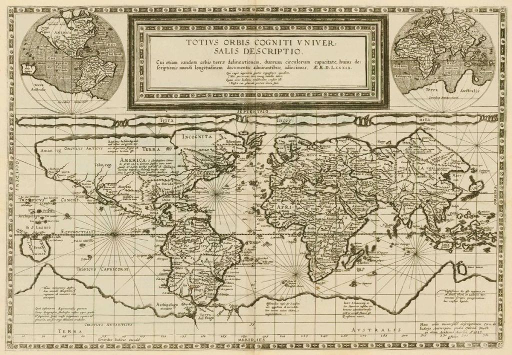
Marinus of Tyre’s Map
Marinus left a notable mark on the annals of geography through his lost treatise, known to us only through the gleanings found in the remarks of Ptolemy. Flourishing c. 120 AD, Marinus’ innovations in map construction and the creation of nautical charts ushered in a new era in cartography. His most enduring legacy lies in his pioneering assignment of proper latitude and longitude to each location—a revolutionary departure in the science of mapping.

Marinus established his prime meridian through the westernmost land within his purview, the fabled Isles of the Blessed, situated in the vicinity of the Canary or Cape Verde Islands. The parallel of Rhodes became his benchmark for latitude measurements. Notably, he introduced the concept of an equidistant rectangular projection, a cartographic technique that still finds application in map creation today.
Despite the elusiveness of his original work, Marinus’ impact resonates through Ptolemy’s accounts. He ventured into uncharted territory, becoming the first in the Roman Empire to depict China on maps, unraveling the mysteries of a distant and enigmatic land. His meticulous approach involved a thorough study of predecessors’ works and the meticulous scrutiny of travelers’ diaries.
Marinus, in his estimations, envisioned the world as separated into an eastern and a western expanse by the formidable trio of Europe, Asia, and Africa. His conception of the inhabited world spanned from the northern reaches of Thule in present-day Norway to the southern realms around Agisymba near the Tropic of Capricorn. Longitudinally, it stretched from the Isles of the Blessed, thought to be around the Canaries, to Shera in China.
In his lexicon, Marinus coined the term “Antarctic,” referring to the counterpart of the Arctic Circle—an innovation that echoed down the corridors of geography. While uncertainties surround the dating of his work, often placed c. 114 AD, Marinus’ estimations of the equator’s length, approximately 180,000 stadia, revealed a remarkable prescience, falling only about 17% short of the Earth’s actual circumference.
Marinus, with his visionary insights and groundbreaking methodologies, occupies a pivotal juncture in the narrative of geographical exploration, leaving an indelible imprint on the evolving tapestry of maps and the quest to unravel the mysteries of the Earth’s vast and varied landscapes.
