Pomponius Mela’s Map
Pomponius Mela, a figure hailing from c. 43 AD, stands as a distinctive presence among ancient geographers, weaving a narrative that both echoes and diverges from the tapestry of his predecessors. His unique perspective unfolds as he divides the Earth into five zones, designating only two as habitable. An intriguing facet of his worldview is the assertion of the existence of antichthones—denizens inhabiting the southern temperate zone, a realm deemed inaccessible to those residing in the northern temperate regions due to the relentless heat of the intervening torrid belt.
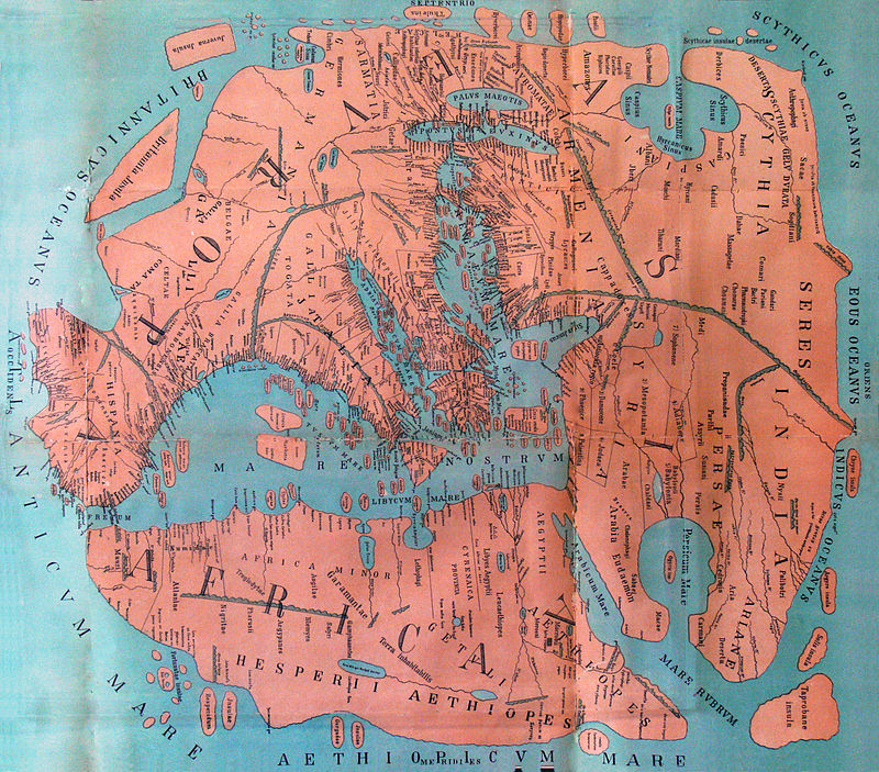
On the delineations of Europe, Asia, and Africa, Pomponius Mela retraces the steps of Eratosthenes, placing the Caspian Sea as a northern extension of the ocean—an idea upheld by classical geographers since the era of Alexander the Great. His depiction of India, while falling short of earlier Greek writers, positions the country in the southeastern corner of Asia, with the coastline curving northward to Scythia and then westward to the Caspian Sea. The Rhipaean Mountains and the enigmatic Hyperboreans find their customary place near the Scythian Ocean in his narrative.
Venturing into western Europe, Pomponius Mela’s insights, perhaps influenced by his status as a Spanish subject of Imperial Rome, surpass those of his Greek predecessors. He crafts a more precise delineation of the western coastlines of Spain and Gaul, skillfully mapping the intricate indentation of the Bay of Biscay. Notably, he is the first to christen and locate the Orcades (Orkney Islands) with a commendable degree of accuracy.
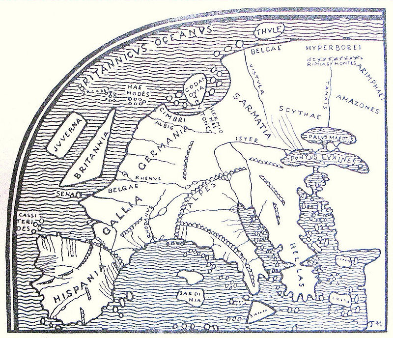
Although his knowledge of northern Europe may appear incomplete, Pomponius Mela casts a spotlight on a great bay, the “Codanus sinus,” to the north of Germany. Within this maritime expanse, he identifies an island of significant stature, “Codanovia.” This toponym resurfaces in the work of Pliny the Elder as “Scatinavia.”
Pomponius Mela’s legacy lies in the nuanced contours he painted onto the canvas of ancient geography—a unique blend of inherited wisdom, regional insights, and an audacious exploration of the unknown, leaving an indelible mark on the evolving narrative of the Earth’s diverse landscapes.

