Posidonius’ Map
Posidonius of Apameia (c. 135–51 BC), a distinguished Greek Stoic philosopher, emerged as a revered polymath in the Greco-Roman world, akin to luminaries such as Aristotle and Eratosthenes. His profound insights into various disciplines were encapsulated in his notable work, About the Ocean and the Adjacent Areas, a comprehensive geographical discourse that explored the intricate interplay of natural forces and their impact on human life.
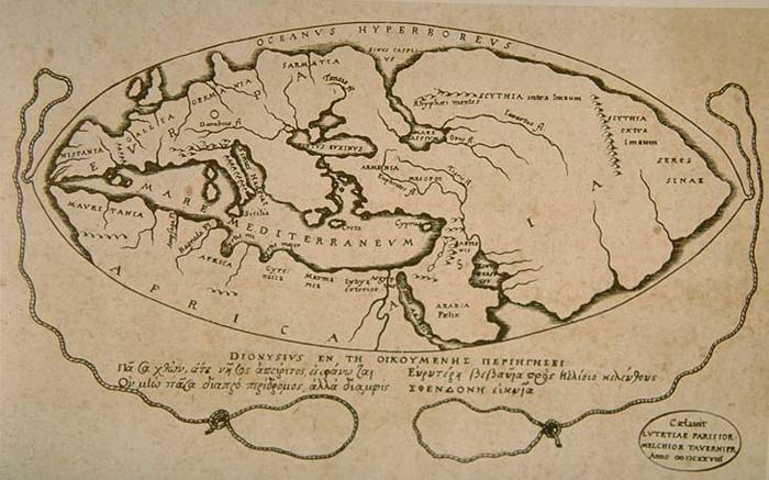
Posidonius’s notable contribution to cartography was his measurement of the Earth’s circumference, a feat he achieved by referencing the position of the star Canopus. His meticulous calculation yielded a measure of 240,000 stadia, roughly equivalent to 24,000 miles—a remarkably close approximation to the actual circumference of 24,901 miles. This accomplishment showcased Posidonius’s methodological finesse, influenced in part by the earlier work of Eratosthenes, who had employed the Sun’s elevation at different latitudes for a similar purpose.
Remarkably, both Posidonius and Eratosthenes achieved remarkably accurate figures for the Earth’s circumference, with their measurements benefiting from a delicate balance of compensating errors. However, the popularized version of Posidonius’s calculation, as revised by Strabo, adjusted the distance between Rhodes and Alexandria to 3,750 stadia, resulting in a revised circumference of 180,000 stadia or 18,000 miles. Ptolemy, in his influential Geographica, not only discussed but also favored this revised figure of Posidonius over Eratosthenes.
This debate over the Earth’s circumference persisted through the Middle Ages, with scholars aligning themselves with either Eratosthenes’ calculation or Posidonius’s 180,000-stadia measure. Posidonius’s enduring influence lay not only in his mathematical precision but also in the divergent perspectives he inspired, shaping the discourse on the Earth’s dimensions for generations to come.

